Best Mountains in Germany to Visit
Wondering about the best mountains in Germany to visit then in this post we will be talking about the same.
There’s a variety of mountains ranges in Germany with a range of sizes, from big to tiny. When you’re in Germany, there are numerous mountain ranges to explore.
A few of the most beautiful mountains that you can see in Germany are:
- Elbe Sandstone Mountains in Bad Schandau
- Zugspitze mountains in Garmisch-Partenkirchen
- Wank Mountain in Garmisch-Partenkirchen.
- Mount Tegelerg in Schwangau
- Merkur Mountain in Baden-Baden
Take a look at our maps of top mountain ranges in Germany before finding out more about these breathtaking landscapes.
A list of the Best Mountains in Germany
It’s not uncommon to find a gorgeous mountain and an incredible castle on the same day across various locations throughout Germany. Here’s a look at a few of the fascinating mountains in Germany.
Bavarian Forest (Mountains in Germany)
Also called Bayerischer Wald In German, The Bavarian Forest is a low mountain range located in Bavaria, Germany. These mountains are located across their Czech frontier and joined through The Sumava (Bohemian Forest) on the Czech side.
Geographically, the Bohemian Forest and the Bavarian Forest are part of a similar mountain range.
The highest peak is Grosser Arber’s “Great Arber,” 1456 meters. The principal stream that flows through the region is the Regen, created through the union between White Regen and Black Regen. It runs through the mountains to Regensburg, the capital city. Regensburg.
A large portion of the range of mountains is owned and managed through the Bavarian Forest National Park (240 km2). The park was established in the year 1970. It was also the original National Park in Germany.
Black Forest Mountain Range
The Black Forest (Schwarzwald) is a forest-covered mountain range between the Rhine valley’s boundaries to the south and west. It’s located in Baden-Wurttemberg, the southwestern part of Germany.
You can find the highest peak in this mountain range in Feldberg. It is located at an altitude of 498 feet. (1,493 metres).
The Black Forest’s name stemmed from the general dark shade of various pine trees that flourish in the area. Many believe that it’s called the mountains of the black forest because when you climb the mountain, the shadows cast by all the trees make it appear dark.
It is believed that the Black Forest gateau’s origin is the region.
Geography
The Black Forest entails the gneiss core with sandstone covering it. Glaciers covered it throughout the last glacial period. The remains of this period comprise several cirques, including the Mummelsee.
The Danube, Kinzig, Enz, Neckar, Murg, and Rench are a few rivers part of the Black Forest. The forest forms part of the continental divide that separates both the Black Sea watershed (drained by the Danube) and the Atlantic Ocean watershed (drained by the Rhine).
The Black Forest belongs to several counties, in North: Pforzheim, Enz, Calw and Rastatt In central: Ortenaukreis, Freudenstadt and Rottweil. In the south it belongs to Schwarzwald-Baar, Emmendingen, Breisgau-Hochschwarzwald, Waldshu, and Lorrach.
The forest is full of the first. Tourism is the primary sector in the region, while Swabian and Alemannic are dialects that are spoken.
The forest has suffered a lot of damage due to acid rain. It is now just a tiny fraction of the size it was. Many beautiful high peaks and hills were stripped of their vegetation, with the primary growing firs, young firs, and shrubs following the 1999 storm.
Quick Facts The most awe-inspiring mountain range is in the Feldberg at 4,898 feet. And the Seebeck at 4751 feet. And the Herzogenhorn at 4,642 feet. And the Belchen at 4,639 feet. And the Schauinsland at 4,212 feet. The Kandel is at 4,072 feet. And the Blauen at 3,822 feet and the Hornisgrinde at 3,819 feet.
Eastern Alps (Mountains in Germany)
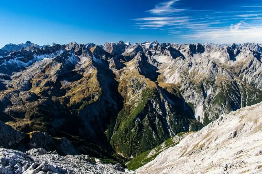
Eastern Alps is the name used to describe the eastern portion of the Alps. The term is used to describe the territory to the east of Splugen Pass in Switzerland. The Posterior Rhine is the boundary to the north of the Splugen Pass. The Liro river, as well as Lake Como, form the borderline to the south Pass.
The Eastern Alps include parts of Switzerland and the majority from Austria and Liechtenstein, and a portion that is part of south Germany, northern Italy, and Slovenia. The eastern border is Wienerwald (Vienna Woods) and The Viennese basin, the transition zone between the Carpathian mountains.
The most notable portion of the alps region located in Germany is the Bavarian Alps. Mittenwald is popular skiing and hiking location in Europe. The alps range shares the Austrian frontier.
The Eastern Alps are traditionally divided according to the Alpenvereins-Einteilung (arrangement of the Alpine Club) into several dozen small regions, each assigned to the Northern Calcareous Alps, the Central Eastern Alps, or the Southern Calcareous Alps. You can find further details on the respective pages of their respective regions.
The most awe-inspiring peak located in the Eastern Alps is Piz Bernina (4052 m) in Switzerland. It is followed by Ortler (3905 meters), located in South Tyrol/Italy, and the Grossglockner (3798 meters), located in Austria.
In the Wurm glaciation that occurred, it was noted that the Eastern Alps were drier than the Western Alps. The contiguous ice shield ended at the end of the Niedere Tauern region of Austria.
This enabled many species to endure the ice age within the Eastern Alps, where they were not able to survive elsewhere. This is why many kinds of the plant are indigenous to those of the Eastern Alps.
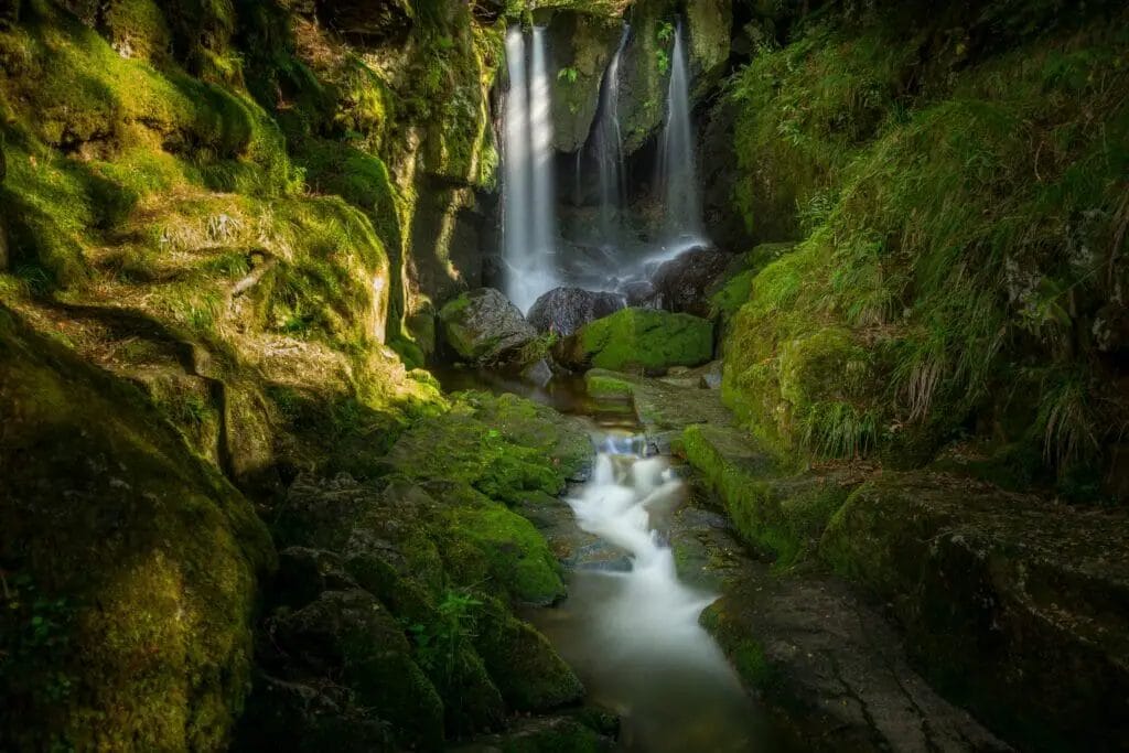
Elbe Sandstone (Mountains in Germany)
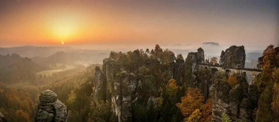
The Elbe Sandstone Mountains (German Elbsandsteingebirge, Czech Labske piskovce) are one of Germany’s mountain ranges. It is situated with the two states Saxony (in the southeastern part of Germany) and Germany’s Czech Republic.
The name is derived from sandstone that was cut by the Elbe river. The Elbe.
The vacation region of the Elbe Sandstone Mountains is located in the Saxon Switzerland National Park. It is one of Germany’s most unique zones with beautiful nature and is located right in the middle of Dresden. Tourists and hikers can take in the stunning scenery due to the stunning rock-covered landscapes of Elb Sandstone Mountains, trees that jut out of the surrounding forests, and roaring rivers in the gorges that are soaring.
Other interesting places include Konigstein Fortress, Fort Hohnstein, Fort Stolpen, Weesenstein Castle, and Kuckuckstein Castle.
There are 14,000 climb routes that mountain climbers can climb 1100 freestanding summits. Visitors can take the breathtaking natural landscapes along the asphalt Elb cycle route. You can also experience the stunning scenery on the steam-powered paddleboat, which forms part of the oldest fleet of this kind.
E.g. 1730 in 1730, the discovery of the first sulfurous and ferrous resources within Bad Schandau caused a brisk demand for this area as a wellness resort. This resulted in the construction of baths.
Sandstone
Sandstone constitutes the base rock that has round to sharp-edged grains. By DIN 4022, the grain diameter ranges from 0,063 mm to 2 millimeters. The term “sand” refers to the defined size of the grain. A particular mineral does not be sandstone as compared to other rock types.
Quartz is typically thought of as the principal mineral. The different particles of sand, also known as the constituents, may also be composed of rocks or other minerals. Fragments.
The sandstone’s constituents consist of greater than 90% quartz grains is referred to as quartz sandstone. If a sandstone component leads in a dimension that exceeds 2 millimeters, it is classified as Conglomerate Sandstone (e.g., Olsbrucker sandstone). Sandstones with grains smaller than 0,063 mm or 0,002 millimeters are silty or clayey sandstones.
Genesis of Sandstone
Sandstones are sedimentary rocks formed by the formation of loose sand, the sediment. After Correns, the deposits are thought of as-deposited chemical and mechanical decomposition items after transportation. This could be due to wind, water, or even ice.
Gravity’s force causes the sand’s deposit through mechanical sedimentation.
Sandstone is composed of all elements set off mechanically after transportation and is known as debris. The most common feature of every sedimentary rock type is layering—variations in the conditions for sedimentation cause it. E.g., the availability of residues with different properties or the alteration of grains size in deposits.
The bank that can be seen in sandstone sequences results from repeated interruptions in sedimentation. Sandstone formation can be observed in different deposits.
A sand deposit could occur in the vicinity of rivers, lowlands with nerves, or in the ranges of muzzles in rivers (delta levels). It could also happen within the sea ranges near the coast or on the bottoms of shallows.
The variety of deposit areas referred to with their unique deposit conditions leads to various sandstones that come into the market with a wide variety of sorts. The deposits underwent a distinct growth in the time-based sequence of earth-historical processes,
Layer sequence within the sandstone
The sandstone in this region forms the landscape. It was the bottom of the sea many millions of years back. The large rivers rinsed sand and released materials into the Cretaceous sea.
The rough quartz sand, fine marl, and clay sank and consolidated themselves layer by layer. A compact sandstone plate was created that was up to 600 meters in thickness and around 600 kilometers wide.
- 1. Bohemian massif
- 2. Lusatian-Saxonian block
- 3. Elbe Sandstone territory
- 4. Rhenish massif
- 5. Prehistoric sea from the Cretaceous period
After the sea left about eight million years back, mountain-forming decay started. At first, bursts developed. They were formed when the Lusatian granite massif slowly pushed itself over the Sandstone plate coming from the north.
Estergebirge (Mountains in Germany)
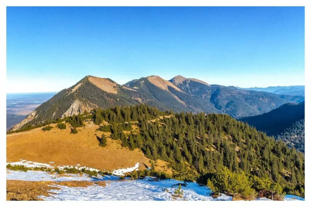
Estergebirge is a small mountain range located in Bavaria. It is classified as an element of the Bavarian Alps or a larger chain of the Northern Limestone Alps.
The range extends for approximately 15 km. The valley of the river Loisach is bordered by it from the west. Walchensee lake and the valley of the river Isar connect this from the east. Krottenkopf (2086 atm) is the tallest peak in the region, extending to the 2000 m elevation.
Some of the most prominent peaks include Krottenkopf (2086 metres), Bischof (2033 m), Hohe Kisten (1922 m), Hoher Fricken (1940 m). A few kilometers from the summit are Simetsberg (1.836 meters).
The 1700 m treeline characterizes the limestone mountain range. Meters.
Estergebirge is relatively quiet. The area is relatively calm, except for Wank (1779 at the height of 1779 meters), as it is the highest peak accessible via cable car. The majority of visitors and mountaineers are drawn to the higher mountains nearby.
These include Karwendel, Wetterstein mountains, and Germany’s highest mountain, Zugspitze massif. The Austrian frontier runs through the Zugspitze massif.
Estergebirge provides various options for trekking and mountaineering both in summer and winter.
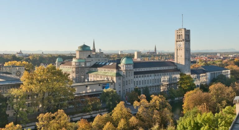
Read More: Best Things to do in Frankfurt, Germany
Fichtelgebirge (Mountains in Germany)
The Fichtelgebirge is a mountain range located in the northeastern region of Bavaria, Germany. It extends across the valley of the Red Main River to the Czech border. This is followed through the more affluent Ore Mountains.
Schneeberg (1053 at 1053 m) is considered to be the most awe-inspiring peak within the Fichtelgebirge range. The rivers flowing from the Fichtelgebirge comprise the Saxon Saale: the White Main (German: Weisser Main) and the Ohre (German: Eger), and the Fichtelnaab that joins with the Waldnaab. Cities located near mountain ranges include Bayreuth as well as Hof.
As the mountains rise to the north and south, there’s an incline to the west. This is the place which is where the Red Main forms the boundary of the mountains.
The Fichtelgebirge draws a lot of visitors both in winter and summer. Many of them come to enjoy recreational activities such as hiking, skiing, and taking in the massive rocks that form.
You can learn more about this place on tourism website of Fichtelgebirge.
Frankenwald (Mountains in Germany)
The Mid-altitude Alps range is located in the northern portion of the Bavarian Alps. The Frankenwald is situated inside the Oberfranken district. The content is the geological connecting point between Thuringian Forest and the Fichtelgebirge.
The Frankenwald is about 45 km (30 miles) in a direction northwest. It is a vast and well-wooded plateau that gently descends toward the Saale river on the north and eastern sides. Saale. It lowers steeply until the Bavarian plain to the west. It is at its highest point (794 metres) at the Dobraberg close to Schwarzenbach am Wald.
There’s a watershed in both the Saale and the Main basins that are part of the watersheds comprising the Elbe and Rhine, respectively.
If you are thinking about travelling to Frankenwald then you can find more information on their website.
Find related: Best Beaches in Germany
Harz (Mountains in Germany)
Harz Harz is an autonomous mountain that lies in northwestern Germany. It is located in the three states Lower Saxony, Saxony-Anhalt, and Thuringia. The Harz is the name that the Harz is derived from the Middle High German word meaning “forest.”
The Harz is a long 95 kilometers (southeast from the northwest) and a length that is 35 kilometers. It covers approximately 2000 square kilometers and has its highest point at Brocken (1141 1141 m), located within the German state of Saxony-Anhalt. A Wurmberg (971 meters) can be described as the most awe-inspiring point in the Lower Saxony part. The population of six hundred thousand resides throughout the cities and towns in the Harz mountains. Harz mountains.
Harz Harz has been divided into two parts: the Upper Harz ( Oberharz) in the northwest and the northwest and Lower Harz ( Unterharz) in the southeast. The Upper Harz has a higher altitude and has forests of fir. It’s Lower Harz gradually descends towards the land around it and features meadows and deciduous forest that mix with fields.
The first settlement of the Harz was established just 1000 years ago. The forests of the past rendered the region inaccessible. Silver deposits in the vicinity of Goslar, the town’s capital Goslar have been discovered since 968. Later mining operations were set up all over the mountains.
The region’s wealth decreased when the mining industry was exhausted in the 19th century. It was the reason why people went from the town for a period of time. Tourism eventually brought prosperity back to the town.
Between 1945 to 1990, a border between the two countries was established through the Harz. The west was part of the FRG and the eastern part of the GDR. Nowadays, the Harz is a famous tourist place for summer hiking or winter sports.
Harz National Park Harz National Park is situated in the Harz. It encompasses the Brocken and the surrounding wilderness areas.
You can learn more about Tourism in Harz here.
Hunsruck (Mountains in Germany)
The Hunsruck is a low mountain range found in Rheinland-Pfalz (Rhineland-Palatinate), Germany. It is bordered by Moselle (north), Rhine (east) along with Nahe (south) and river valleys,
The Hunsruck is followed by the Taunus mountains that lie on the eastern bank of the Rhine. To the north, behind the Moselle, it is observed via the Eifel.
Pfalz is located southwest of Nahe.
The majority of the hills aren’t over 400 meters in height. The highest mountains in the Hunsruck have the names they have given to them. They include The (Schwarzwalder) Hochwald, the Idarwald and the Soonwald as well as Binger Wald. Binger Wald. The highest peak is Erbeskopf (816 metres).
Towns within the Hunsruck comprise Simmern, Kirchberg, and Idar-Oberstein Kastellaun as well as Morbach. Frankfurt-Hahn Airport, which is a growing cargo airport and low-cost carrier, is also in the region.
The slate mines are located in Hunsruck, and the climate is characterized by the rainy season.
Check Similar: Best Adventure Parks in Germany
Lusatian (Mountains in Germany)
Lusatian Mountains (German: Lausitzer Gebirge) is a mountain range in Europe. It lies on the southeastern boundary to Germany and borders the Czech Republic, east of the Elbe River, a continuation of Erzgebirge that lies to the west of Elbe.
Lusatians, in themselves, are an extension of the Sudeten Mountains located in Bohemia along with Moravia. These mountains connect with them with the Carpathian Mountains. The adjacent part in the southeast of Germany is known as Lusatia.
The most prominent peak in the area is Luzicke (Lausche) (793 meters. Other noteworthy summits include Penkavci Vrch (Finkenkoppe) 792 meters, Jedlova (Tannenberg) 774 m, Klic (Kleis) 760 meters, Hvozd (Hochwald) 750 meters as well as Studenec (Kaltenberg) 736 m.
Ore (Mountains in Germany)
The Ore Mountains ( Erzgebirge) are an area that spans 150 km of the border. They are located on the frontier of Germany within the Czech Republic. They stretch from the western boundary of Saxony up to the Elbe river.
The western parts of the mountains are home to the highest peak elevations. Klinovec (1244 m) on the Czech side and Fichtelberg ( Klinovec (1244 meters) is located on the Czech side and Fichtelberg (1214 m) on the German side. Fichtelberg (1214 meters) is the highest mountain within the range on the German side. In the west, the mountains are joined by the less Bavarian Fichtelgebirge.
In the east of the region, there are the Elbe Sandstone Mountains on both banks of the Elbe river, which could be seen as the easternmost part of the mountain chain. To the east of the Elbe, the mountain range continues to be known as the Lusatian Mountains. Its Ore Mountains slope gently away towards the north, and cities like Zwickau as well as Chemnitz are situated on the slopes below. The southern slope is very steep.
The Ore Mountains were virtually unsettled in the Middle Ages and covered with dense forests. In the 15th century, the discovery of tin and silver deposits caused an increase in the size of mountains and the establishment of cities. The name comes from mineral wealth resources.
Segmented Erzgebirge The name comes from its name about the Tuscan city of Arezzo. This city was a producer of such exquisite metal that it was named the German term for metal. Gebirge are “mountains.” The Mountains are also well-known winter sports spots.
The Ore Mountains are famous for the many Christmas celebrations. With the demise of Tin and silver deposits mining, the miners needed to find alternatives to provide their families with food.
In addition to weaving and lace-making, they were also involved in carving wood. Nutcrackers, Smoking Men, Pyramids (carousels featuring figures from The Christmas Story or of mining), and Schwibbogen (wooden archways with windows that have candles that symbolize the opening of mines) are just a few of numerous Christmas decorations from ore mountains. The ore Mountains.
Seiffen, within Seiffen in the East Ore Mountains, was a place of excellence for wooden toy manufacturing.
Rhon (Mountains in Germany)
The Rhon Mountains are a low mountain range located in central Germany. Hesse, Bavaria, and Thuringia share a border with Thuringia. Here, the Fulda River and its valley are the only mountain ranges that separate them. They result from the volcanic activity that was once prevalent, that originated from the Vogelsberg Mountain.
The mountains within the German territory are famous tourist spots. The hikers come to enjoy the 6000 kilometers (3,750 miles) of trails through the stunning landscape. Gliders have been attracted to the region since the beginning of the 20th century.
In recent times, farm stays are thriving in the area.
The parts of Rhon were designated as a Biosphere Reserve in 1991 by UNESCO due to the unique high-altitude ecosystem found in the area.
The highest points of the Rhon comprise:
- · Wasserkuppe 950 m (3,110 ft), (hessian Rhon)
- · Kreuzberg (mountain) 928 m (3,040 ft) (bavarian Rhon)
- · Schwabenhimmel 926 m (3,040 ft) (bavarian Rhon)
- · Heidelstein 913 m (3,000 ft) (bavarian Rhon)
- · Milseburg 835 metres (2,740 feet) (hessian Rhon)
- · Feuerberg 832 m (2,730 ft) (bavarian Rhon)
- · Ellenbogen 814 m (2,670 ft) (thuringian Rhon)
Spessart (Mountains in Germany)
The Spessart is a hill chain located in northern Bavaria and the southern part of Hesse, Germany. Hesse’s main river borders it along three sides, which creates the shape of a long curvature. Two cities of significant size are situated at the base of Spessart: Aschaffenburg and Wurzburg.
While the Spessart is a circular hill, the main ridge runs from southwestward to northeast. It is followed by an Odenwald located in the southwest and the Rhon in the northeast.
The highest point in the region is Geiersberg (586 meters). Except for its edges, this area is not populated. Two nature parks, Bavarian Spessart and Hessian Spessart, take up large parts of hills.
Sudetes (Mountains in Germany)
It extends across east Germany stretching from eastern Germany to the Czech Republic and Poland. The Sudetes can be referred to as Sudety or Sudeten, are a range of mountains located in Central Europe. With a height of 1,602 meters, Snezka-Sniezka’s Krkonose Mountains, located on the border between Poland and Czech, are the highest mountain range.
Sudetes are divided into: Sudetes are subdivided into:
1. Western Sudetes
- — Lusatian Mountains (Germany along with the Czech Republic)
- – Karkonosze/Krkonose/Giant Mountains (Poland and the Czech Republic)
- — Jizera mountains (Poland along within the Czech Republic)
2. Central Sudetes
3. Eastern Sudetes
In the last ten years, Krkonose Mountains have increased winter sports tourism. Its ski resorts are now an excellent replacement for the Alps.
Some of the most famous towns within this region include Zittau (Germany), Karpacz (Poland), Szklarska Poreba (Poland), Spindleruv Mlyn (Czech Republic), Harrachov (Czech Republic)
The name Sudetes originates from the Sudeti Montes, which is a Latinization of the word Soudeta ore.
An alternative etymological explanation could be the origin of Latin studies which is plural in the sense of sides “spines,” which can describe spiny fishing gear or even spiny roads.
The precise area of the Sudetes isn’t entirely exact since it has been changed throughout time. For instance, the name was first used prior to World War II to refer to Sudetenland, a German area of Sudetenland.
The Germans living in Bohemia were known as Sudeten Germans. They were a large part of Bohemia. Hitler changed the definition of Bohemia to refer to the entire mountainous southwestern region of Czechoslovakia in addition to. Under this pretext, he convinced his future enemies to surrender the Czech defense line, which left it without a choice. The Germans soon took over Czechoslovakia.
The old Sudetenland definitely did not have the same significance. It was at the very least that part of the Northwest frontier in modern-day Czechoslovakia, which probably extended into the north. It formed part of the Hercynian Forest that was mentioned by a variety of old writers.
Taunus (Mountains in Germany)
A mountain range located in Hesse, Germany, The Taunus forms an area of the Rhenish Slate Mountains. It is bordered by the Main, Rhine, and Lahn river valleys.
The mountains continue to be a part of the Hunsruck on the other aspect of the Rhine. The mountains are located in the Hochtaunuskreis and the Main-Taunus, Rheingau-Taunus and Rhein-Lahn districts.
It is not to be confused with the higher Feldberg within the Black Forest. The Grosser Feldberg (880 m above sea level) is the highest point. It was used in the Feldbergrennen hillclimbing competition along with rallying events. The second highest is Kleiner Feldberg, and then it is the Altkonig (798 m) and the last Iron Age hill fort (La-Tene A approximately. 400 BC) located close to the summit. It is also one of the best day trips from Frankfurt to do.
It is believed that the Roman Limes were built across the Taunus. The Saalburg, which is now a restored Roman castellum, is home to the museum. The Alamanni arrived here after the decline of Limes (in the 259 or 260th century AD).
In this way, a few Alemannic cemeteries are located in the southern part of the Taunus (Eschborn). This region was converted to Frankish following The Battle of Tolbiac.
That was all about the mountains in Germany, If you think we missed anything then do suggest in comment box below.
FAQs: Best Mountain Ranges in Germany

Get your Notion Travel Planner Template!
Embark on your next adventure with the Wanderlust Planner, the ultimate Notion Travel Planner Template. Organize your wanderlust-fueled dreams and turn them into unforgettable journeys. Whether you’re a seasoned globetrotter or a newbie explorer, this template has you covered.